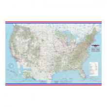
PILOT'S LAMINATED WALL MAP

5 625
₽
Арт.
13-11248
Описание
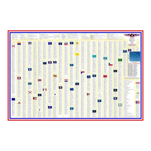
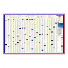
This map measures 3 feet by 2 feet and is encapsulated on both sides by a rugged 3 mil laminate for durability. The map is extremely detailed and includes hundreds of airports (civil and military), vor's, ndb's, terrain features, national parks, cities, time zones, etc. The back of the map has a very detailed AM radio frequency guide for all 50 states, the District of Columbia, Puerto Rico, and the U.S. Virgin Islands.
Features
- Contains state information including capitals, square mileage, population, and nick names along with each state flag
- Great for pilots and aviation enthusiasts
- Flight plan information, ATC light gun signals, cruising altitudes, and a crosswind component chart included
Отзывы Оставить отзыв
Вопросы и ответы
Отзывы ещё не добавлены