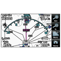
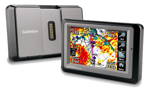
| Leveraging Garmin’s industry-leading expertise in both Aviation and Automotive GPS, the versatile aera series of touchscreen portables take fingertip navigation to a whole new level. Featuring crisp 4.3-inch QVGA wide-format displays, all four aera models come with preloaded automotive maps, a built-in terrain/obstacles aviation database, patented Panel Page instrument display, and more. So, wherever you fly or drive, you can count on aera to provide the complete door-to-door guidance package. |
 |
The aera 550: A Premium Choice
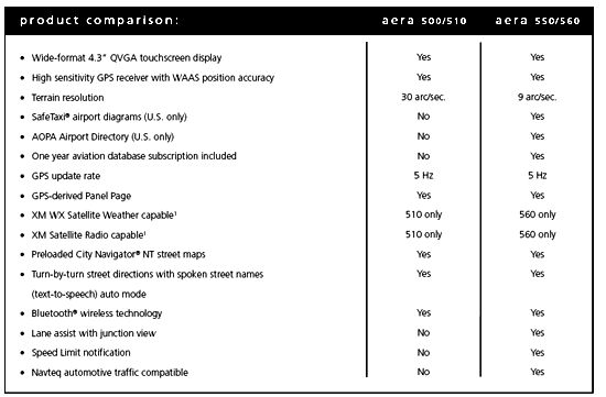
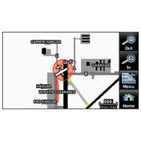
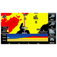
Stepping up from the aera 500 model, the aera 550 brings added features, performance, and more advanced pilot/motorist capabilities to the overall product design. Terrain/obstacles graphics are shown in higher-resolution 9 arc-second detail on the aera 550 display (providing over 11 times more onscreen resolution than the standard 30 arc-second versions). And, as in all the aera models, GPS updating is provided at a super-fast 5 Hz rate. In addition to detailed flight mapping, the aera 550 comes fully preloaded with Garmin SafeTaxi® charts for over 950 U.S. airports – while an included AOPA Airport Directory database gives you detailed listings, phone numbers, facilities and fuel location information on over 7,400 U.S. landing sites, as well as airports of entry for Canada, Mexico and the Caribbean. A full year of prepaid database updates is included with your aera 550 purchase.
Elevate Your Expectations
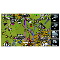
To enhance situational awareness, the aera 550’s graphical Terrain page offers both overhead and vertical profile views of the topography you’re overflying. To help keep pilots aware of special airspace activity, over 683 parachute drop zones are detailed in the Americas navigation database. Plus, a database-driven terrain advisory feature offers TAWS-like color coding and pop-up alerts when obstructions or ground proximity conflicts are projected to impact your flight path. There’s an IFR map mode that lets you navigate on high or low enroute airways. And for help with traffic separation, an optional power/data cable (sold separately) makes it easy to interface your aera 550 with the Garmin GTX 330 Mode S transponder in your aircraft, thus enabling you to access and display TIS traffic alerts in busy terminal airspace throughout the U.S. Moreover, you can also use the aera to load communication frequencies into your Garmin SL 40 Comm or SL 30 Nav/Comm transceiver.
Attention Road Warriors
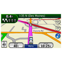
When it’s time to hangar the airplane and head for the open road, your Garmin aera 550 never misses a beat. It’s “dual boot” design enables full automotive GPS capability, graphically supported by preloaded City Navigator® NT street mapping. Operating much like Garmin’s popular nüvi® line of touchscreen auto navigators, the aera 550 offers voice-guided turn-by-turn directions with text-to-speech audio technology that calls out streets by name. In addition, there’s built-in Bluetooth® support for wireless hands-free calling with your compatible mobile phone. Other premium features available on the aera 550 include lane assist with junction view, speed limit notification, Navteq traffic alerts¹, and more. Plus, there’s a unique ”smart mount” for the aera that helps get you on your way with instant clip-and-go transition from aircraft to automotive mode.
Garmin aera series: It’s the ultimate fly/drive option.
¹Navteq traffic alerts require the GTM 20 (sold separately). Traffic content not available for all areas. See www.navteq.com/rdstraffic for traffic coverage areas.
Inthe box:
| aera 550 |
| 1 year of prepaid database updates |
| Yoke Mount with power cable |
| Battery pack |
| Portable friction mount |
| USB cable |
| Vehicle power cable |
| Pilot's guide |
| Carry case |
|




Отзывы ещё не добавлены